17 / 11 / 2015
Winter is coming!
After a sustained period of settled mild weather it looks like we finally have some snow heading our way!
A weather front is set to hit the western Alps sometime around Friday afternoon bringing with it wintery precipitation. As the weather front is riding a mild westerly airflow initially any major snow looks like it may be reserved for the higher more north westerly resorts of the 3 Valleys and the Mont Blanc area.
As we head further into the weekend though northern arctic air will start to control the weather and have a dramatic effect on the freezing levels. From a high of around 3000mts on Friday we expect it to drop to below 500mts by the end of the weekend.
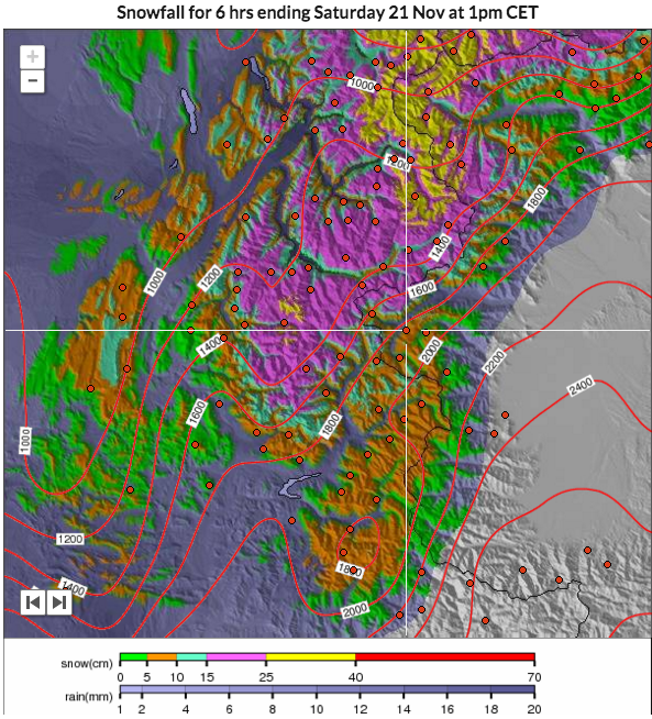
Ironically it is as the freezing levels drop that we will see precipitation easing off. Never mind though, Saturday is looking good for us with some forecasts predicting around 30cm of snow on the higher grounds.
So just to recap, expect snow to start falling sometime Friday PM with the heaviest falling on Saturday. It will start to ease on Sunday but temperatures are set to get a lot colder thereafter.
The lifts are due to start running 2 weeks on Saturday so whatever we get now is welcome. Importantly the temperature will drop, could this mean we see the first cannons firing next week?